

In the nine months since Helene’s arrival in western North Carolina, geologists have worked steadily to better understand how to reduce future landslide-related impacts on life and property. While landslide themselves cannot be prevented from happening under extreme precipitation conditions, decision making during, and particularly before, a storm can save lives and reduce damage to infrastructure and personal property. Understanding what made certain landslides more damaging than others requires both extensive fieldwork and study of remote sensing data, like lidar imagery. ALC Principal Geologist Jennifer Bauer and Project Geologist Philip Prince recently presented some of the findings of their post-Helene work in US Geological Survey seminars. Video recordings of the talks are linked below. If you have ever wondered what a geologist sees in one of Helene’s thousands of landslide scars, these videos will give a glance of how we do our work day-to-day.
Jennifer Bauer
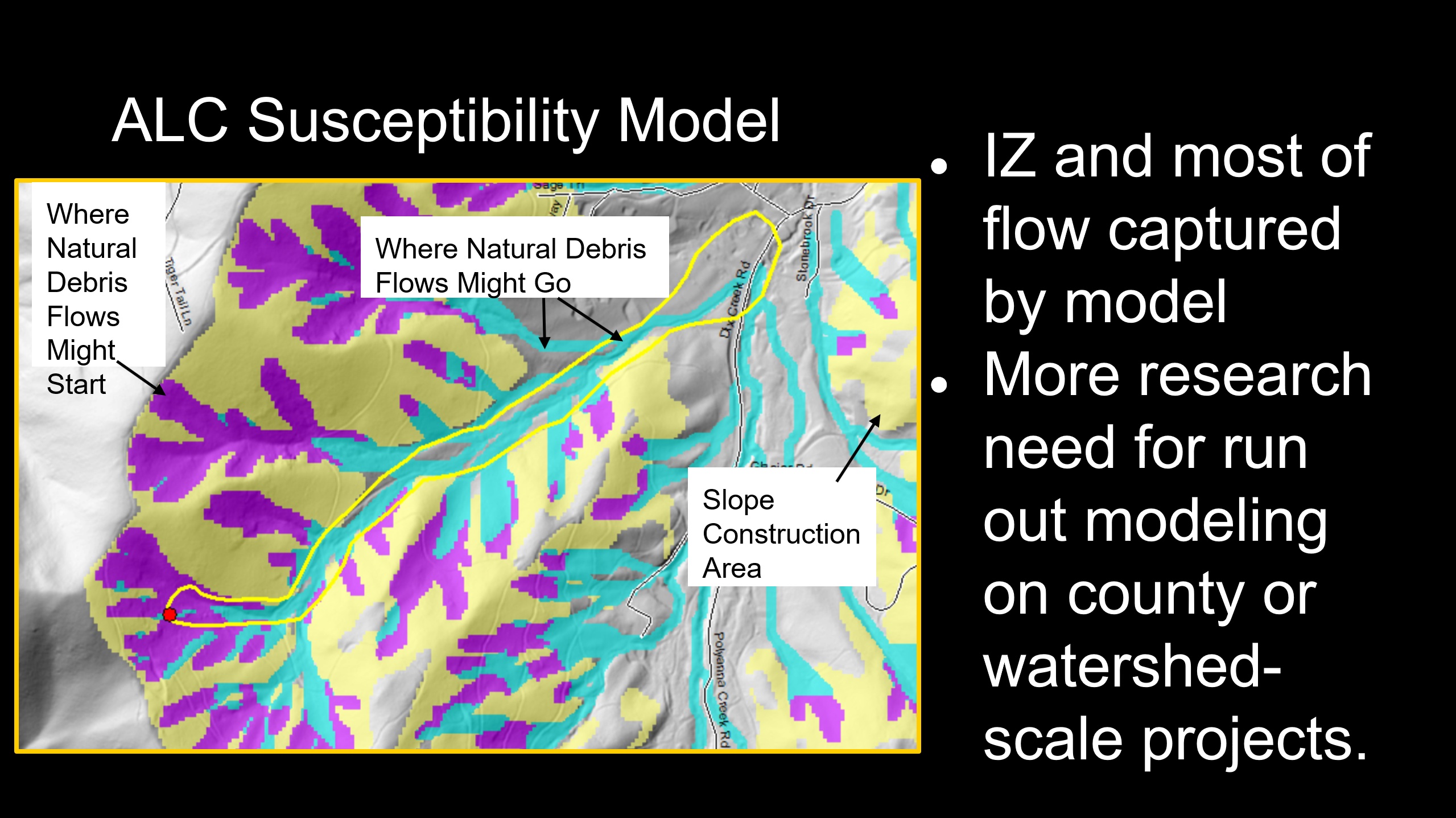
Jennifer’s talk focuses on the use of landslide mapping and modeling to understand and (more importantly) communicate landslide hazard before storms hit. Understanding landslide potential in a given landscape requires that geologists understand the landslide history of a landscape. Landslide inventories involving both lidar imagery analysis and lots of boots-on-the-ground fieldwork help geologists learn what has happened in the past.

Once the geologic details that can produce landslides are understood (slope shape, slope steepness, soil type, etc.), models of potential landslide hazard zones can be developed. As Jennifer’s talk shows, the overwhelming majority of Helene’s landslides came from mapped hazard areas, but not every hazard area produced a landslide…this time. Hazard mapping can show mountain residents areas that are potentially dangerous is storms (don’t worry; it’s not everywhere-not even close) and help with decision making regarding where to live and how to prepare for the next big event.
Philip Prince
Philip’s talk is centered around the geologic details of Helene’s debris flow landslides. Debris flows are fast-moving, fluidized landslides that can travel long distances very quickly. Often called “mudslides,” debris flows actually carry huge amounts of rock and boulder debris and tremendous numbers of trees, so a debris flow impact is much more damaging than what might result from mud alone.

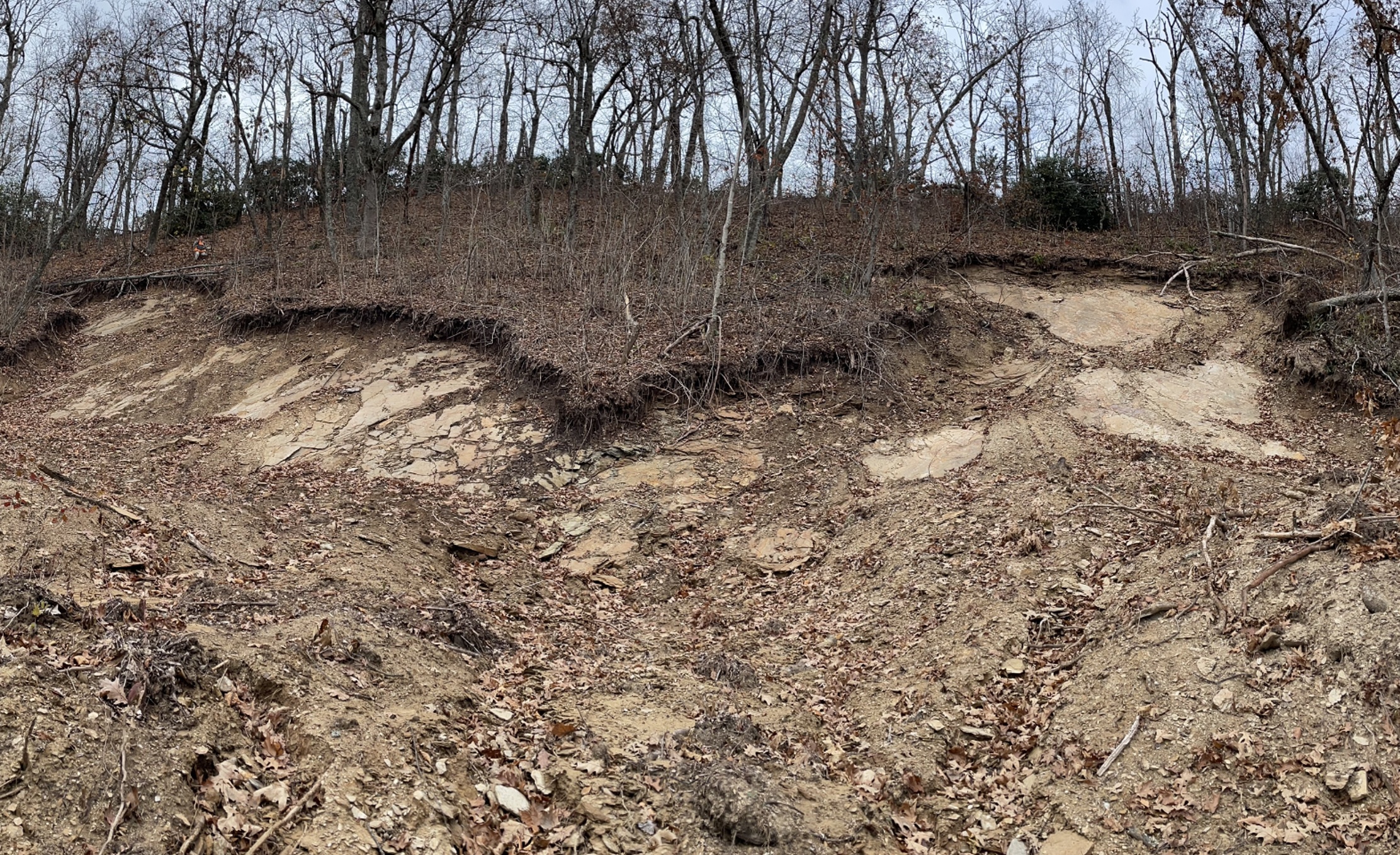
Philip illustrates where debris flows start in the landscape and how they accumulate so much material on their path downslope. A large debris flow could cover a football field with a few feet of mud, rocks and trees, but even small debris flows are surprisingly destructive. By understanding what type of geologic materials and slope settings produced debris flows during Helene, we can better understand what areas may be hazardous in the next event. Planners can also what parts of the landscape may be more susceptible to landslides when disturbed for building, as well as what areas at the foot of the mountains might be reached by debris flows.

