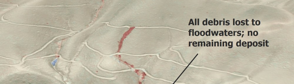
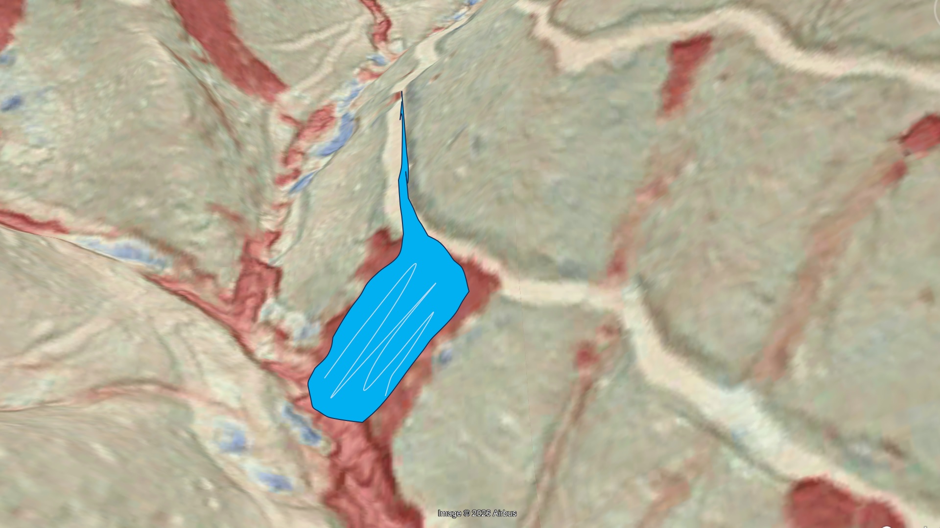
As more post-Helene lidar imagery is evaluated, we are beginning to understand just how many of Helene’s debris flows (and other landslide types) were triggered by road embankments. The Haywood County, NC, debris flow shown below is a particularly good example. The image shows a lidar change detection map draped over Google Earth, with red indicating surface elevation loss (scour) due to the debris flow.
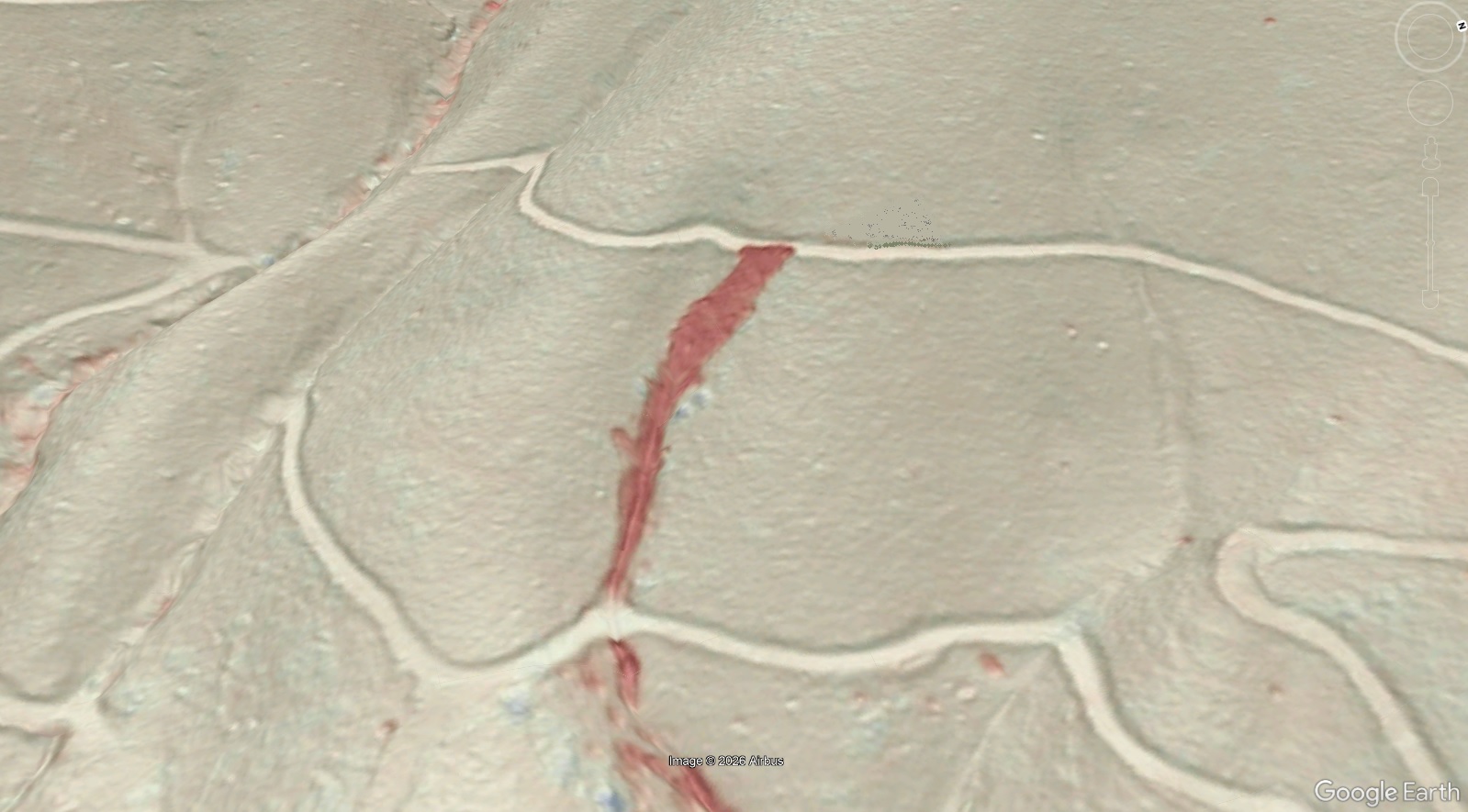
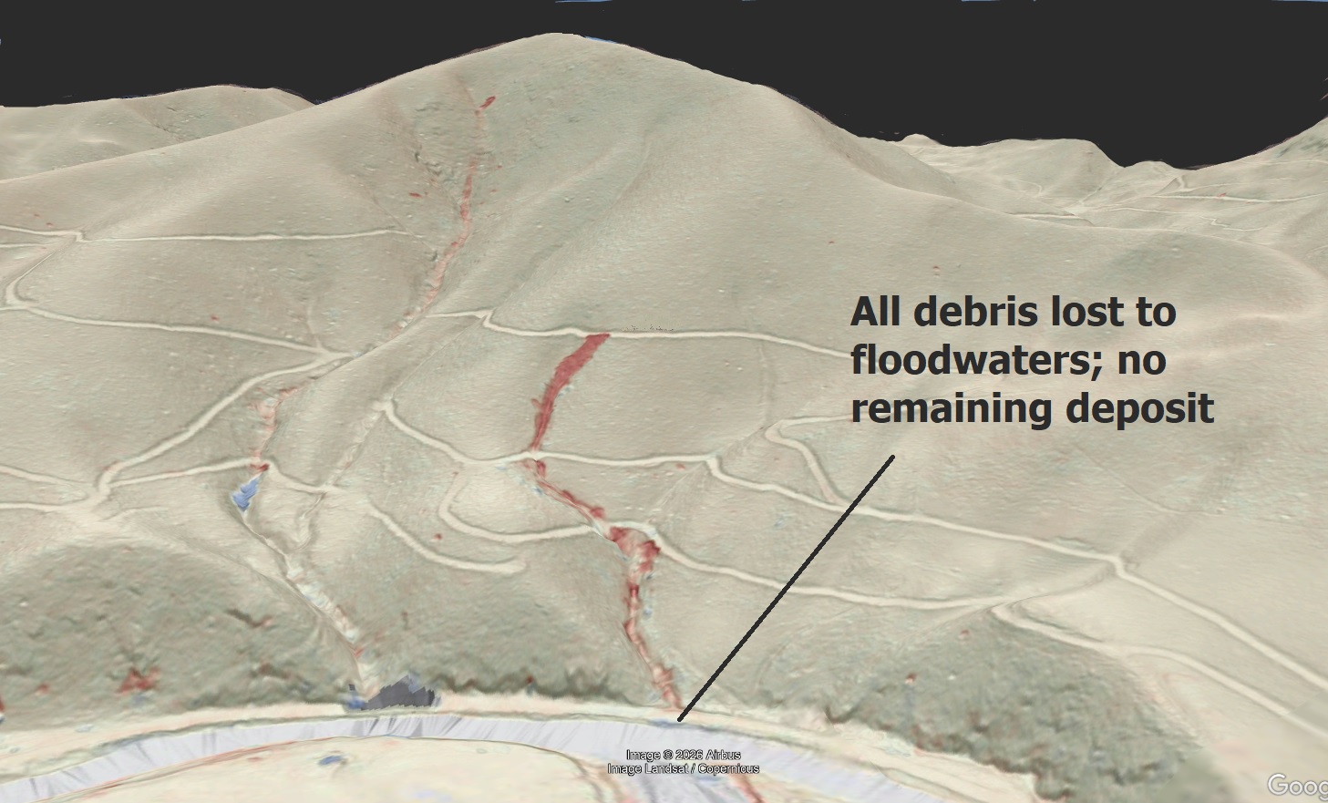
The scoured area just below the road grade is about 50 feet wide. Scour continued down the slope, with the debris flow discharging its volume into the floodwaters of Richland Creek. Like nearly all of Helene’s debris flows from any source, this one made a massive contribution of sediment to the stream network.
Debris flows originating from road embankments (both logging roads and maintained roads) were still generated by initiating landslides, not runoff alone. Runoff would have accelerated soil saturation, triggering the landslide within the fill material of the embankment and likely some of the underlying colluvium. These failures are frequently observed near bends in road grades where upslope ditch water could spill out, flow across the grade, and reach the embankment in significant volume. The image below shows the Haywood County debris flow’s position relative to slope of the road grade and nearby bends.
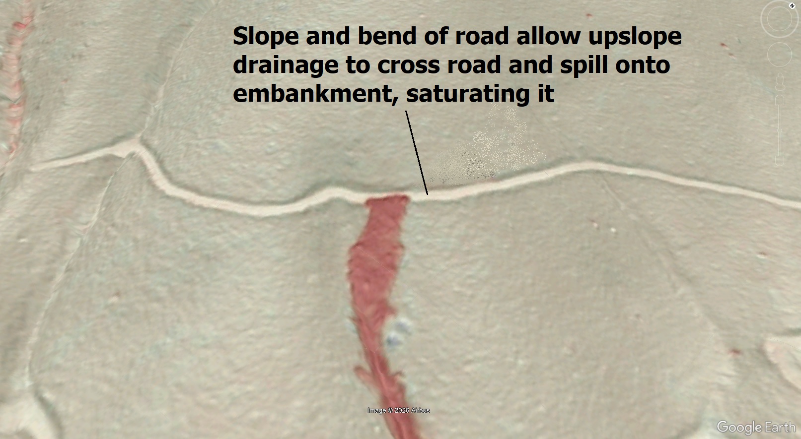
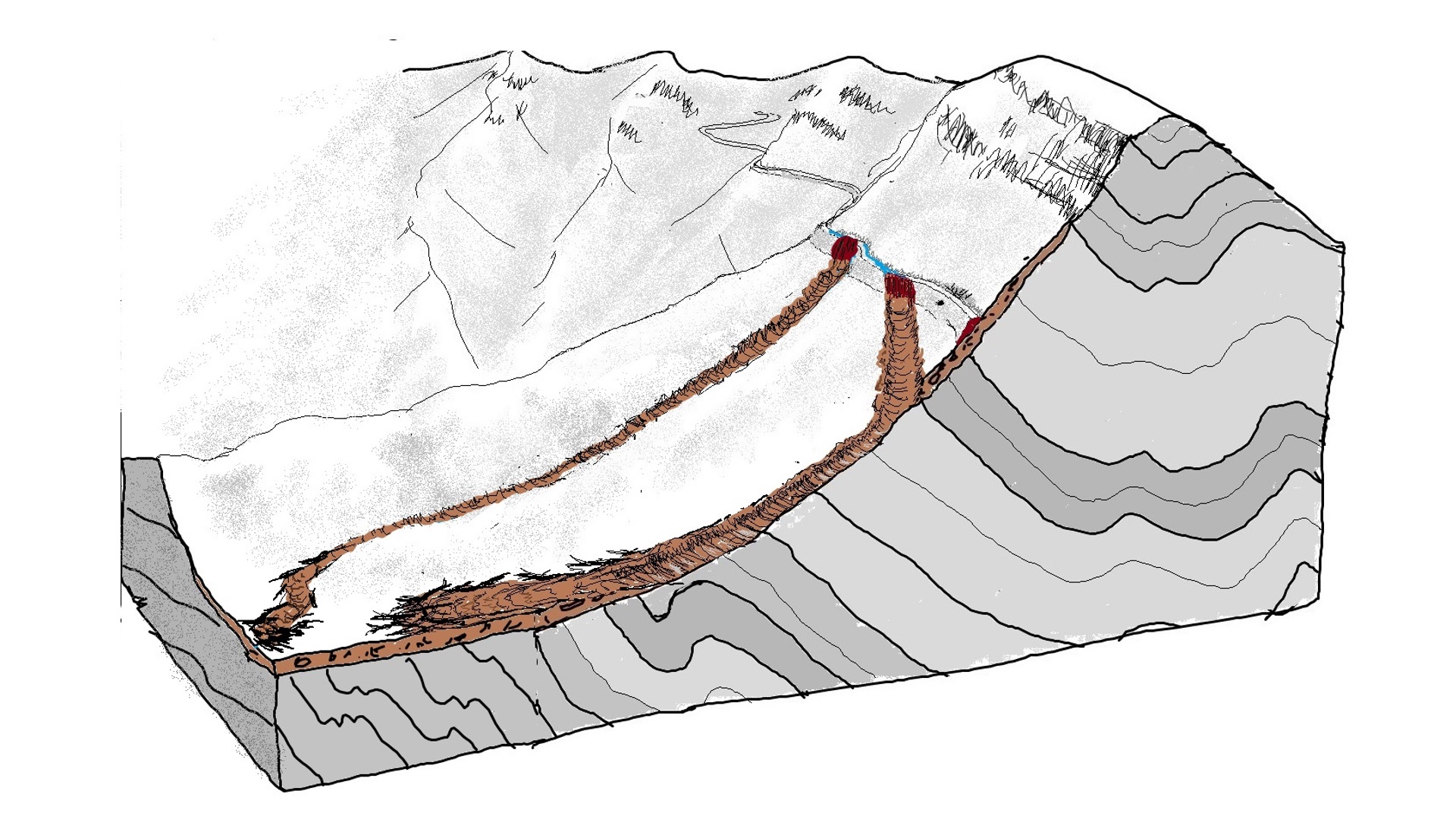
Because the road grade bends are associated with the road moving into a concave portion of the slope where more colluvium is stored, the initiating landslide would directly impact and entrain saturated colluvium in an already debris flow prone area, leading to a “runaway” effect. The GIF below provides a basic conceptual model of this overflow idea. Note that the embankment fill in the foreground initially fails as a landslide triggered by saturation due to overflow. It is not a product of progressive erosion, meaning the failure produces a large and almost instantaneous release of fluidized fill soil to the slope below, which progresses to a debris flow.
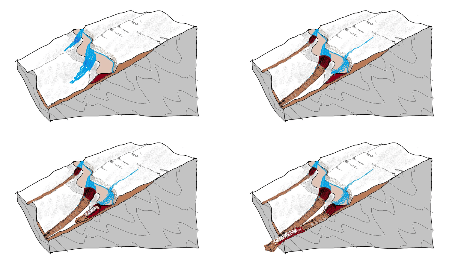
An expanded view of this type of diagram would how the initiating slide scouring natural colluvial soil and trees from the slopes on its path downhill, greatly increasing the debris flow’s volume from the initial slide.
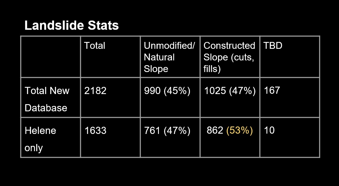
As of mid-October, over 50% of Haywood County’s slope failures are related to modified slopes. While not all of these are debris flows from road grades, the sheer volume of material transported by a significant debris greatly exceeds the total volume moved by many smaller slides, making road grade embankments and associated debris flows inadvertent sources of significant landscape change. Cut slope failures are extremely numerous as well but appear to be less likely to produce long-runout debris flows (though they absolutely can).
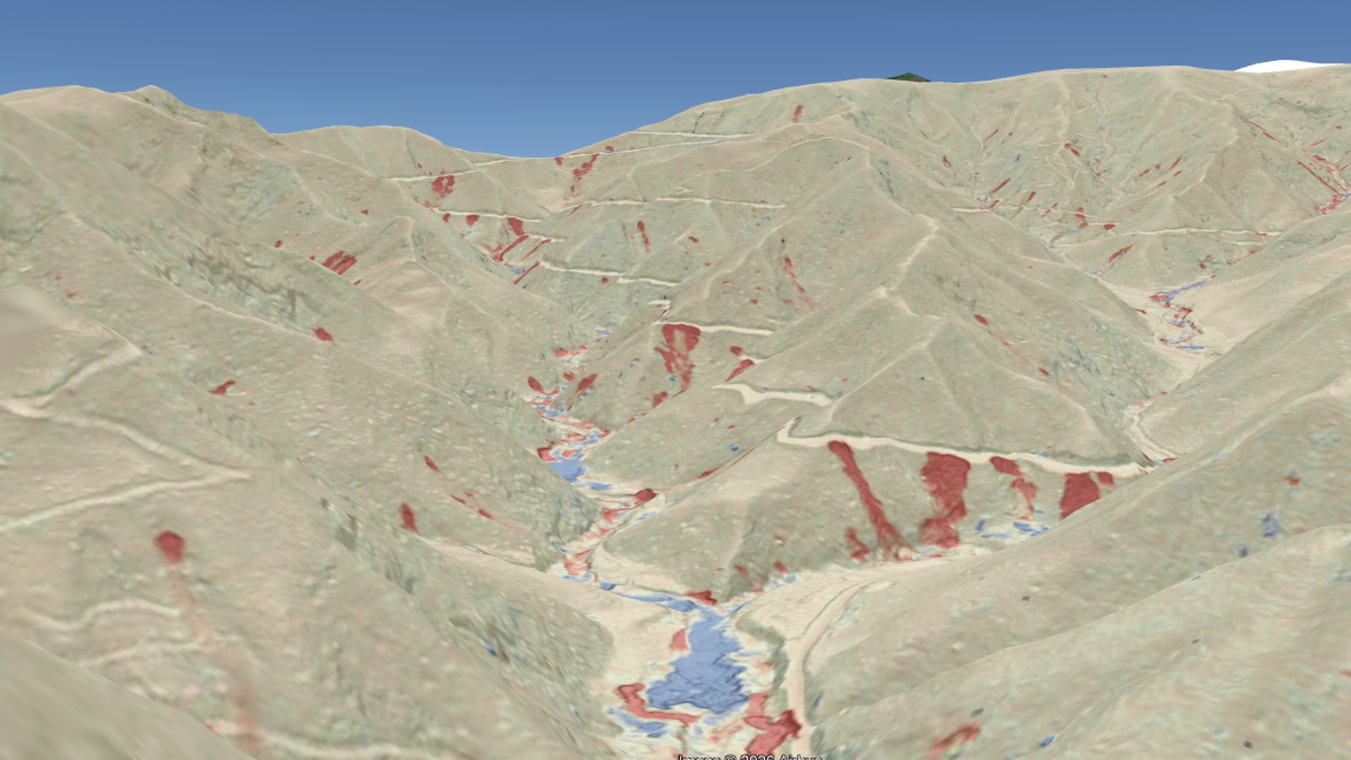
The Haywood example at the start of this post is good because it provides a single, clear-cut feature to introduce the topic. In many Helene-impacted counties, debris flowing from road grades was on another level. The shots from McDowell County below, southwest of Hwy 80, is one such example. The unsurfaced forest road grade running from top left to bottom right introduced a huge volume of sediment and wood to the stream through debris flows.
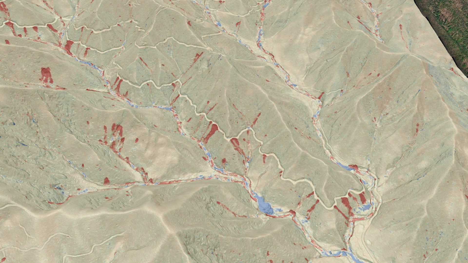
Looking upstream…note the huge blue pile of deposited debris in the foreground. Much of this debris is wood, with soil and rock debris mixed into it.
The spillover mechanism may have been at work here:
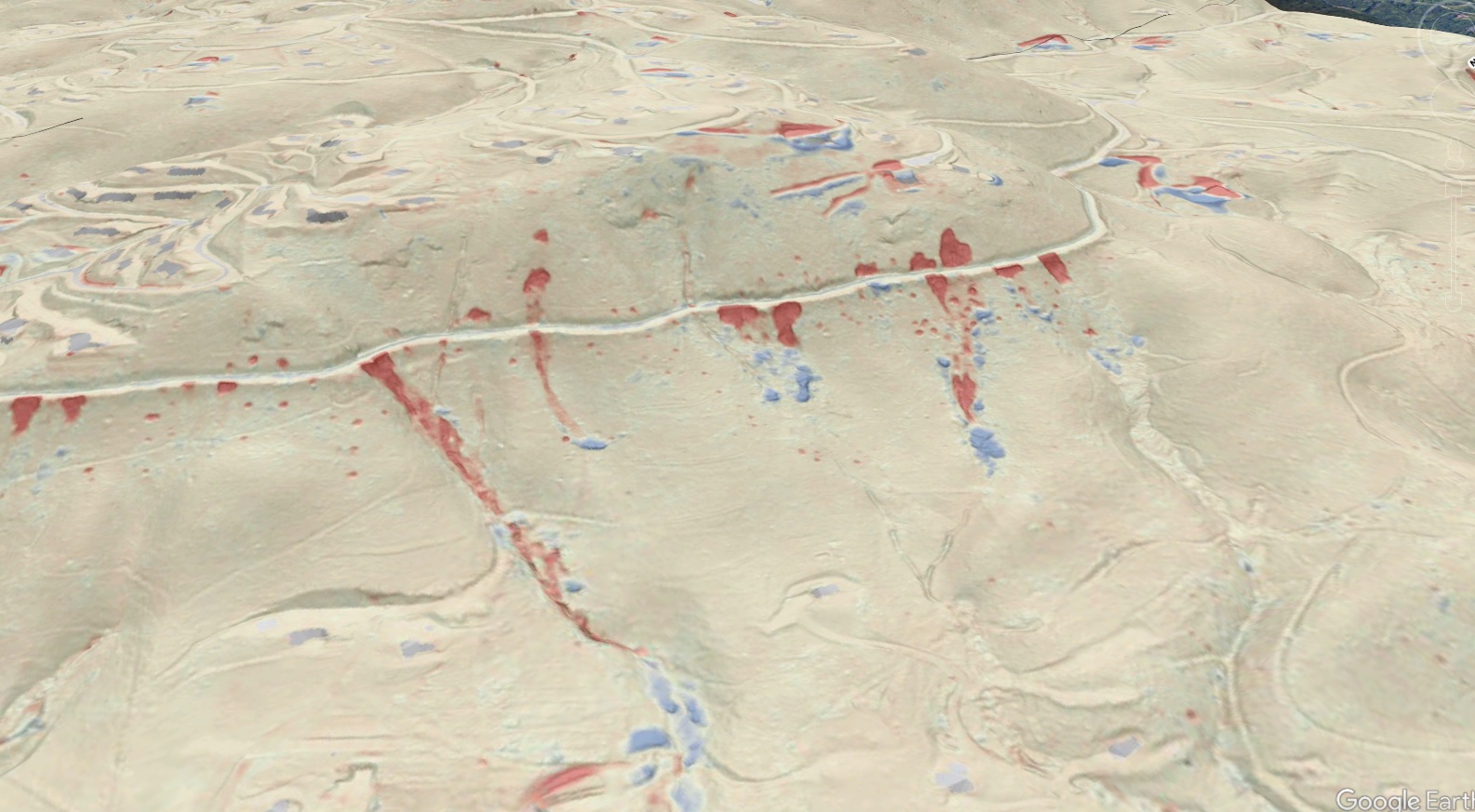
Surfaced roads were not immune from debris flows. Davis Mountain Road, in Henderson County, experienced numerous huge failures. Fortunately, the runout of these debris flow was limited.
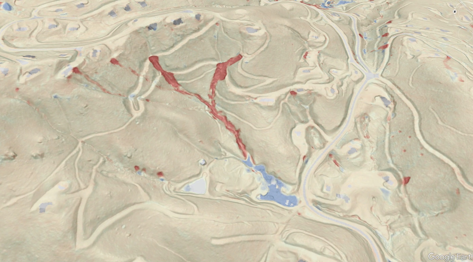
Unsurfaced, “legacy” road grades, either from development or logging, exist on many slopes in developed areas in our region. While they may not be heavily used or even drivable, they proved to be the source of considerable hazard during Helene. The debris flows below in the Laurel Park area of Henderson County are a good example. A house located within the large blue deposit zone was destroyed; fortunately, the occupant had left prior to the debris flows. Note that these debris flow may have originated around blocked culverts, where water ponded and saturated embankments to the point of failure and fluidization.
Some road grades experience intact, low displacement landsliding that dropped a portion of the road without fluidizing the slide mass and triggering a debris flow. The Avery County example below (Minneapolis area) is interesting because it involves a small fluidized slide and much larger, but slightly displaced, slide mass the cuts the whole road grade. The sequence of these events is unclear. Landslide features like the bigger slide mass are quite numerous but are more challenging to identify due to their subtle expression. Check out the head of the slide, which is faintly red and crosses the road, just up and left of the blue arrow indicating likely runoff movement.
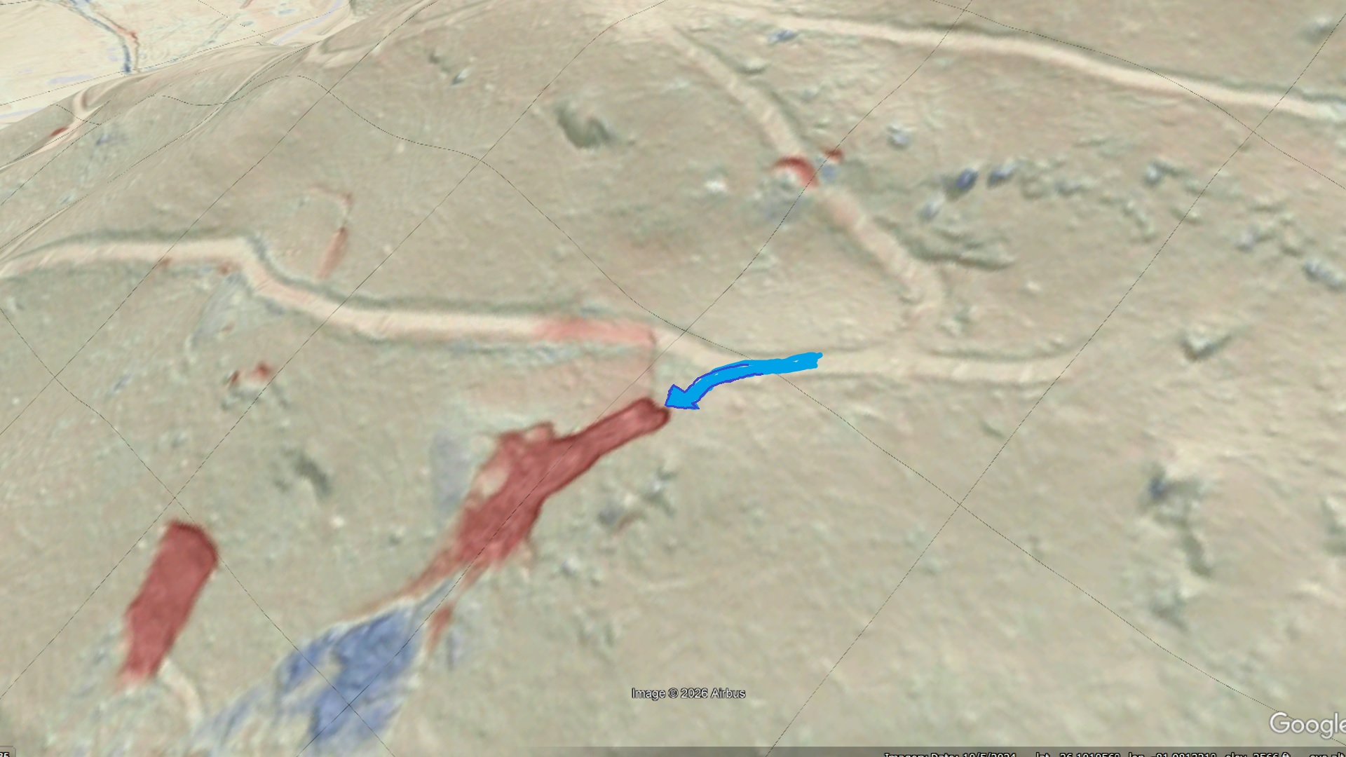
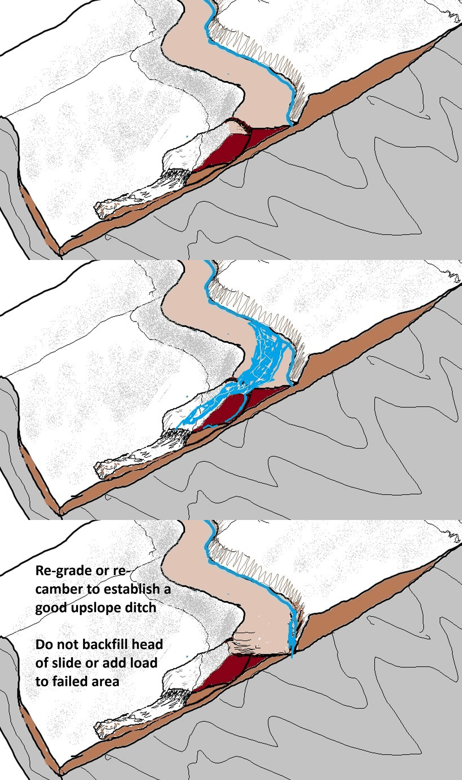
What would you do with a feature like this? Landslide mechanics tell us that filling in the lowered portion of the road grade to level it back out isn’t the best idea. That approach would keep future runoff water off the slide, but it also re-loads the slide and sets the stage for future movement. From the purely water management standpoint, improving the upslope ditch and re-grading or cambering the road to keep water off the affected area would not re-load the slide and would reduce saturation, which would reduce weakening during heavy rain events. The GIF below gives the general idea. Downslope solutions, like a well-founded retaining wall, are also valid, but may reach beyond the scope of what is possible for large stretches of unmaintained mountainside road.
Since our area has so many old mountain road grades, is there anything to do to be proactive? The answer is yes–improving and controlling drainage to prevent spillover and embankment saturation, as well as improving culvert design, can reduce focused embankment saturation and the resulting embankment failure. Steps as simple as deepening and opening upslope ditches to prevent plugging and overflow and opening blocked culverts can have significant impact.
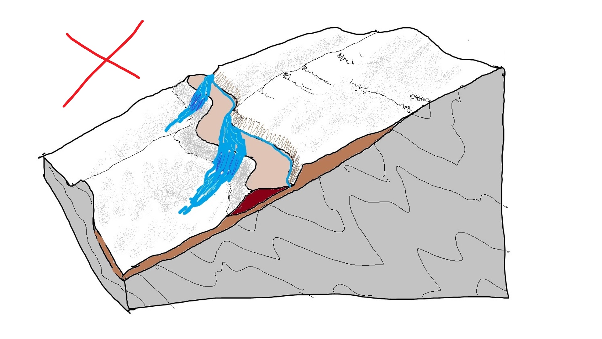
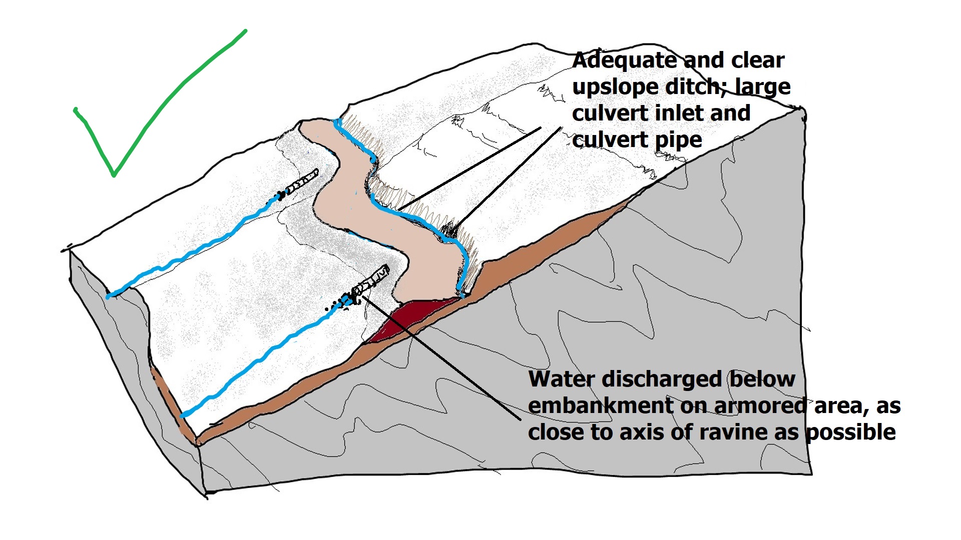
A storm event like overall Helene sequence will always produce huge numbers of landslides in our region, but reducing failures of man-made features could significantly impact the overall landslide total, particularly with respect to highly mobile debris flows. Efforts to improve the condition of old road grades must, however, not create more disturbance to the slope than they reduce. As we continue to evaluate Helene’s impacts through the study of lidar imagery, we may be able to prepare better plans of action for use in the next big event.

