
A new look at a devastating landslide of the 1916 storm–the Jacks Branch debris flow
Note: This post is based on Jule Hubbard’s 2016 article, linked here. It’s a fascinating piece that does an excellent job capturing the human impacts of a notable landslide during the 1916 storm. You should give it a read before continuing… Prior to Helene, landslide geologists in western North Carolina devoted considerable energy towards studying…
Keep reading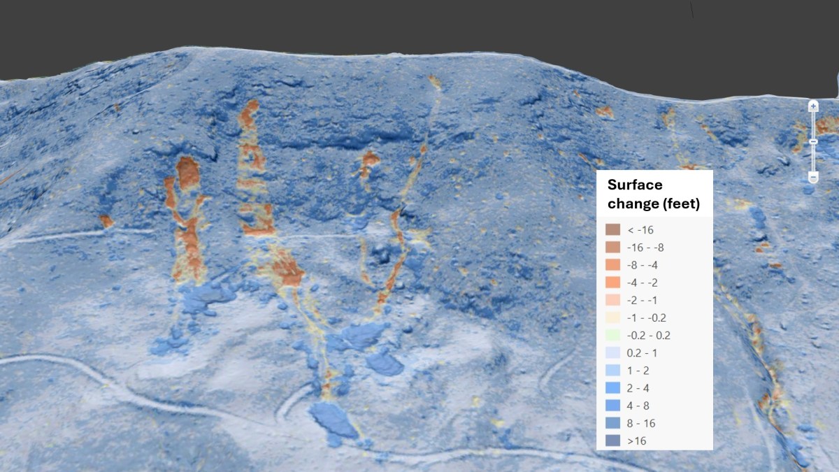
New lidar imagery shows the full extent of Helene’s impacts
by Philip S. Prince Over the last year, numerous collections of aerial imagery have shown Helene’s effects on western North Carolina mountainsides. This imagery has been useful in understanding the extent of the storm’s impacts on the landscape, but remaining tree cover and the natural irregularity of the landscape make it difficult to fully appreciate…
Keep reading
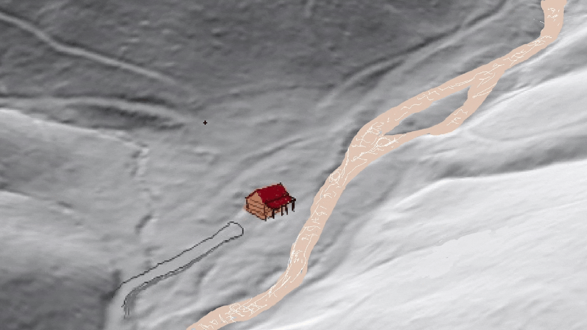
The undeniable value of landslide risk assessment
Landslides (and particularly debris flows) aren’t a daily occurrence in western North Carolina, so knowledge of the landslide risk of a specific property may not always seem important. A few years ago, ALC advised a client against purchase of a high-risk property located in an area that, at the time, seemed quite safe and desirable…
Keep reading
The 1847 debris flow event in Clay County, North Carolina shows crazy storms aren’t a new thing for the region
Seeing the results of past extreme storms in a region is an important part of understanding potential landscape behavior. Thomas L. Clingman (yes, that Clingman) provides an invaluable record of a couple of past storm events in his extensive writings about western North Carolina. His discussion of the results of a storm of July 7th,…
Keep readingSomething went wrong. Please refresh the page and/or try again.
